by Steve Selden | Apr 17, 2017 | Conservation
Mario Tama photographed these breathless Arctic photos from a Lockheed P-3 accompanying a NASA crew carrying out Operation Icebridge, an operation initiated to measure Earth’s glaciers and ice sheets. The stillness, colors and textures of the Arctic landscape left Tama speechless.
“It’s such an unexpected landscape,” he says. “It felt like we were flying over a different planet.”
NASA spends 10 weeks each spring in the Arctic when the ice levels are at their highest using a pair of laser altimeters to record ice elevation and three types of radars to measure snow – one of which reaches 300 feet down to bedrock. Flying shifts of up to 12 hours, the crew surveyed hundreds of miles of coastline along Ellesmere Island in Canada and Greenland. While researchers focused on computer screens, Tama focused his camera on a landscape without scale.
“I was looking at shapes and features that I had never seen in my life,” Tama says. “We’d drop through the clouds or take a turn into a valley, and I’d be sitting there trying to process, what am I looking at?”
Last year the National Snow and Ice Data Center NASA and operation IceBridge announced the lowest ice levels for the Arctic and Antarctic in the past 38 years.
“Changes in Arctic sea ice is seen as one of the primary indicators of climate change,” says Nathan Kurtz, project scientist for Operation IceBridge. “It’s been changing so rapidly—the Arctic has been changing and warming. What we’re trying to do is get a sense of what’s driving some of the bigger changes that we’re seeing.”
Tama’s stunning images remind us all of the majestic beauty of the north that is in jeopardy due to global warming!
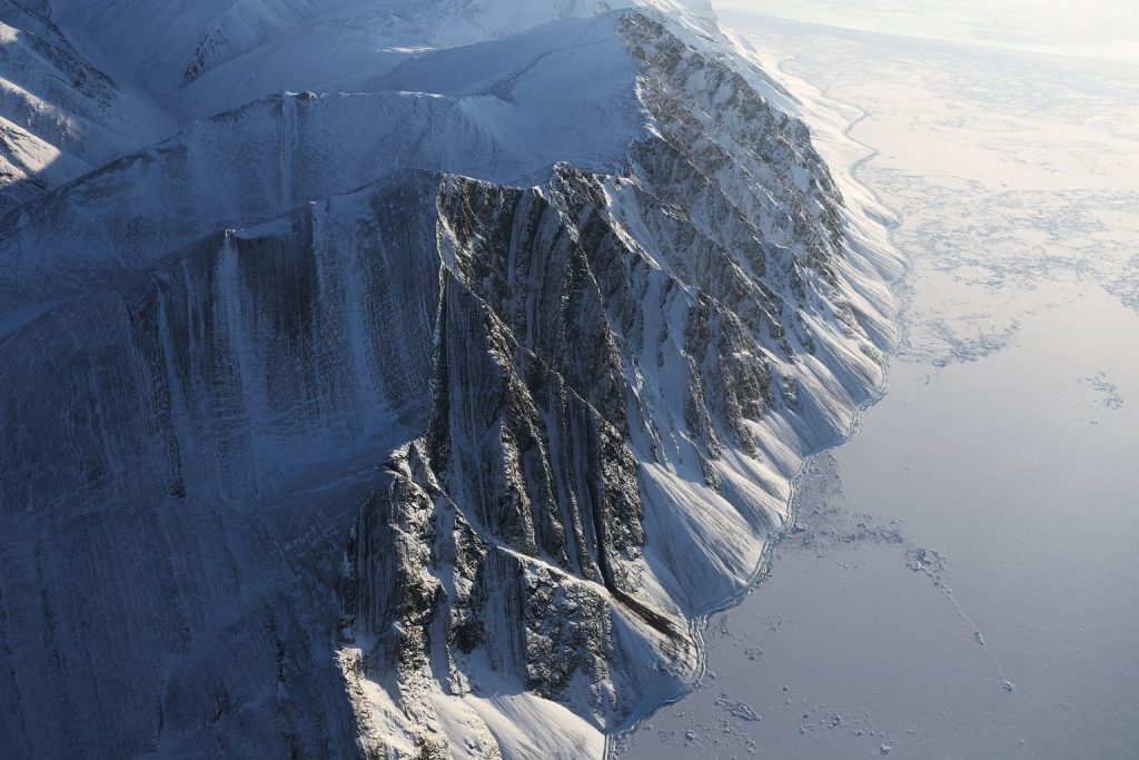
Ellesmere Island ice field. NASA photo.
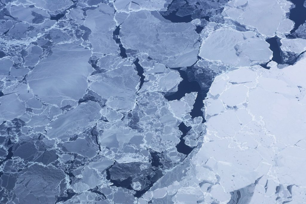
Ice pack near Ellesmere Island. NASA photo.
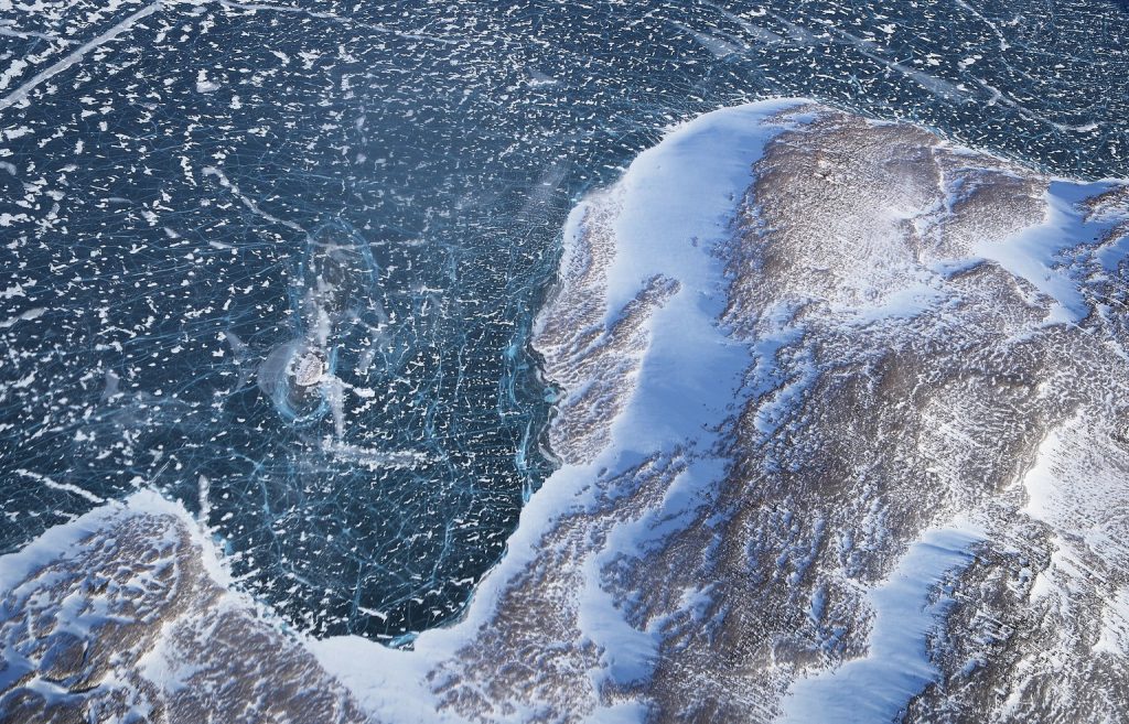
Ice along the Baffin Island coast Greenland. NASA photo.
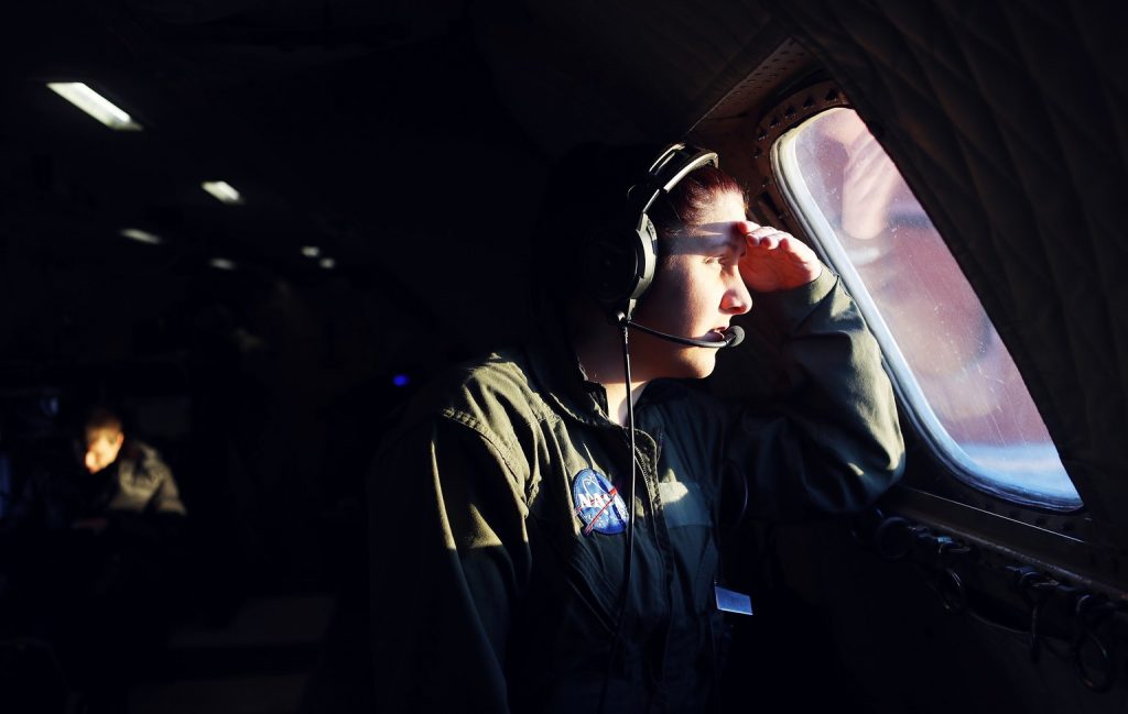
NASA avionics technician surveys the Arctic landscape. NASA photo.
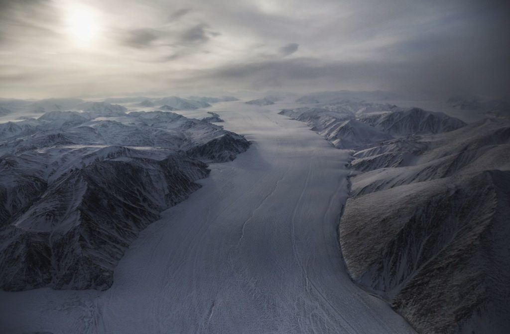
Glacier on Ellesmere Island. NASA photo.
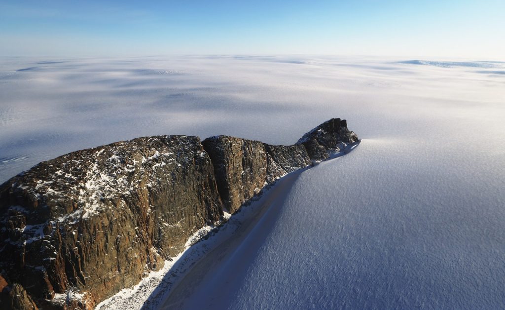
Baffin coast ice field Greenland. NASA photo.
by Steve Selden | Jan 23, 2015 | Churchill News
It’s hard to believe that Canada’s newest territory is almost 16 years old. April 1, 1999 was the official date Nunavut separated from the Northwest Territories. Comprising a major portion of Northern Canada as well as most of the islands in the Arctic region, Nunavut is the fifth – largest country sub division in the world. Nunavut borders with Manitoba and the waters of the Hudson Bay are included in its borders.

The capital is Iqaluit, formerly Frobisher Bay on Baffin Island. Other major communities include the regional centers of Rankin Inlet and Cambridge Bay. In the far north, Nunavut also includes Ellesmere Island as well as the eastern and southern portions of Victoria Island in the west as well as Akimiski Island in James Bay in the far south. It is the only region of Canada that is not connected to the rest of North America by highway.
The youngest territory is the least populous though largest in overall area of all the provinces and territories of Canada. With a mostly Inuit population of nearly 32,000, Nunavut is a sparsely settled region about the size of Western Europe. Alert, the northernmost inhabited place in the world, is also a part of Nunavut.

The territory of Nunavut. Vabmanagement.com. image.
The territory includes all of the islands in Hudson Bay, James Bay and Ungava Bay. If Nunavut were a country, it would rank 15th in area. The population density is 0.015 persons per square kilometer, one of the lowest in the world. Greenland has approximately the same area and nearly twice the population. Nunavut’s highest point is Barbeau Peak (2,616 m (8,583 ft)) on Ellesmere Island.
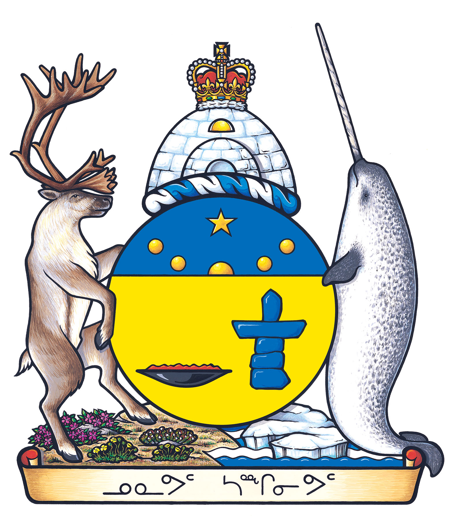
Nunavut’s coat of arms. Image courtesy of assembly.nu.ca
Since the 1976 initial proposal by the 82 % Inuit population of Nunavut, the long journey to the current territorial status was delayed by disputes over land claims. So, after 23 years, the territory was born. It seems slightly odd that a native territory took that long to emerge as such. The name “Nunavut” is derived from the Inuit word for “our land”.