by Steve Selden | Apr 18, 2017 | Churchill Photography
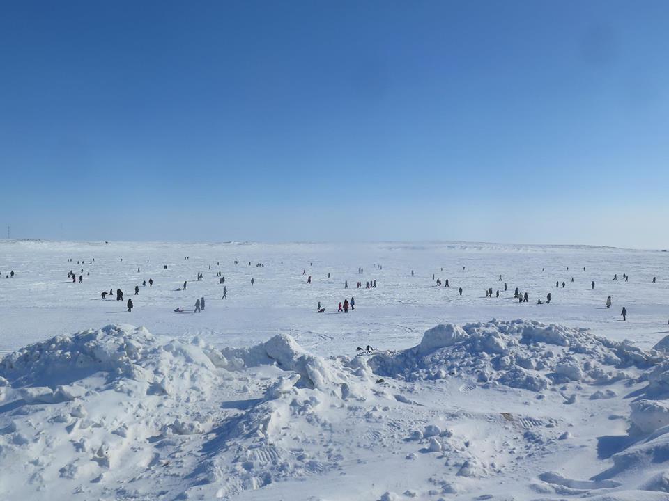
Arctic Easter egg hunt on the Arctic Ocean at Cambridge Bay. CBC photo.
This Easter egg hunt on the frozen Arctic Ocean at Cambridge Bay, Nunavut will make all other egg hunts across the Earth pale in comparison. What a way for the kids to celebrate Easter! I’m sure there were many polar bear monitors around as well!
by Steve Selden | Apr 17, 2017 | Conservation
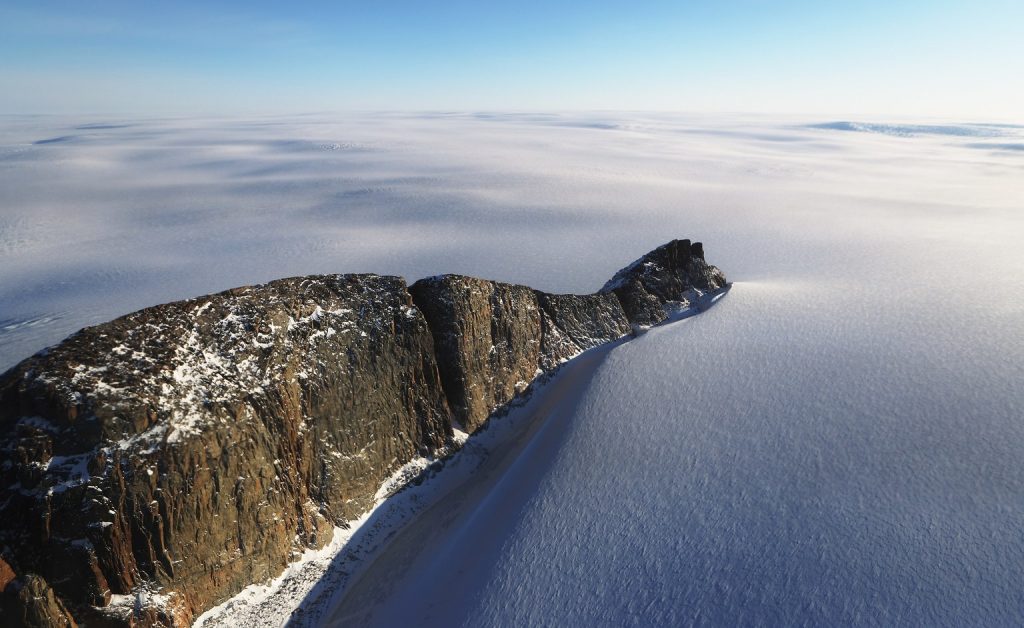
Mario Tama photographed these breathless Arctic photos from a Lockheed P-3 accompanying a NASA crew carrying out Operation Icebridge, an operation initiated to measure Earth’s glaciers and ice sheets. The stillness, colors and textures of the Arctic landscape left Tama speechless.
“It’s such an unexpected landscape,” he says. “It felt like we were flying over a different planet.”
NASA spends 10 weeks each spring in the Arctic when the ice levels are at their highest using a pair of laser altimeters to record ice elevation and three types of radars to measure snow – one of which reaches 300 feet down to bedrock. Flying shifts of up to 12 hours, the crew surveyed hundreds of miles of coastline along Ellesmere Island in Canada and Greenland. While researchers focused on computer screens, Tama focused his camera on a landscape without scale.
“I was looking at shapes and features that I had never seen in my life,” Tama says. “We’d drop through the clouds or take a turn into a valley, and I’d be sitting there trying to process, what am I looking at?”
Last year the National Snow and Ice Data Center NASA and operation IceBridge announced the lowest ice levels for the Arctic and Antarctic in the past 38 years.
“Changes in Arctic sea ice is seen as one of the primary indicators of climate change,” says Nathan Kurtz, project scientist for Operation IceBridge. “It’s been changing so rapidly—the Arctic has been changing and warming. What we’re trying to do is get a sense of what’s driving some of the bigger changes that we’re seeing.”
Tama’s stunning images remind us all of the majestic beauty of the north that is in jeopardy due to global warming!
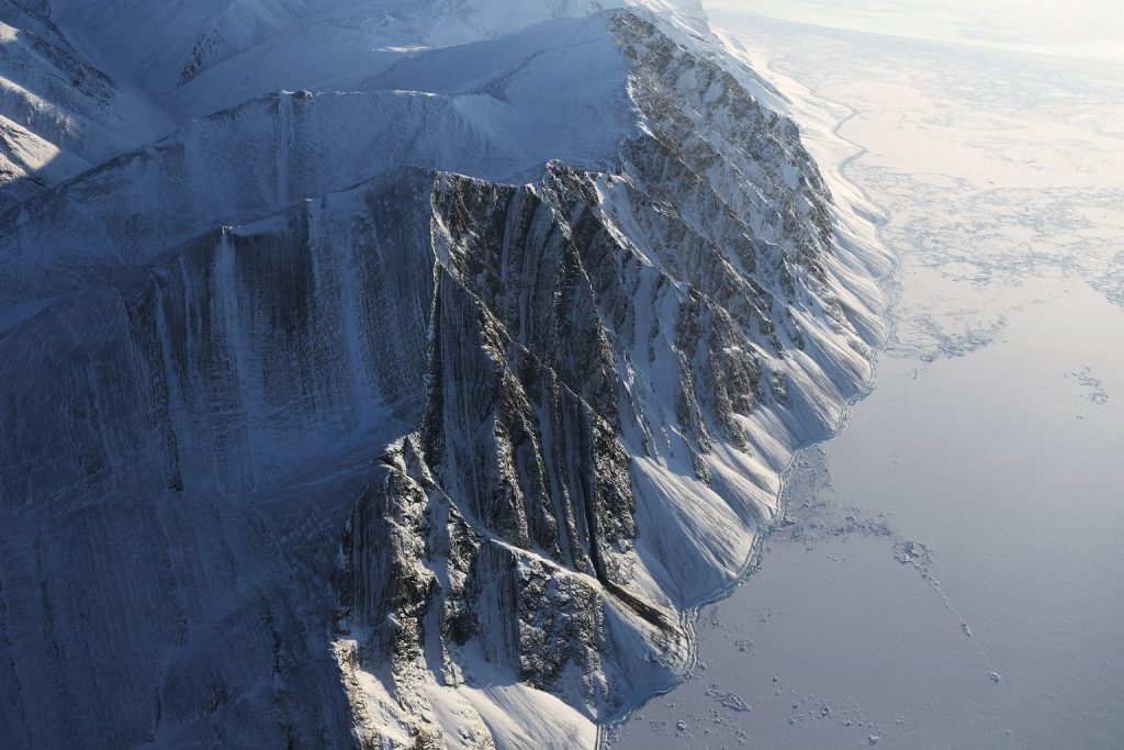
Ellesmere Island ice field. NASA photo.
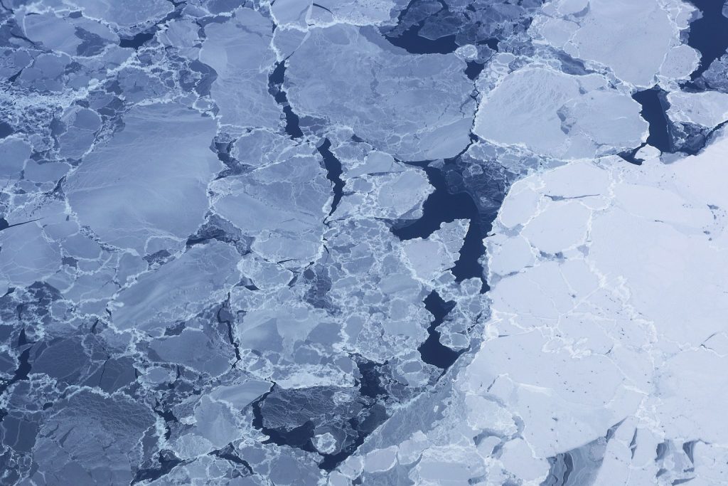
Ice pack near Ellesmere Island. NASA photo.
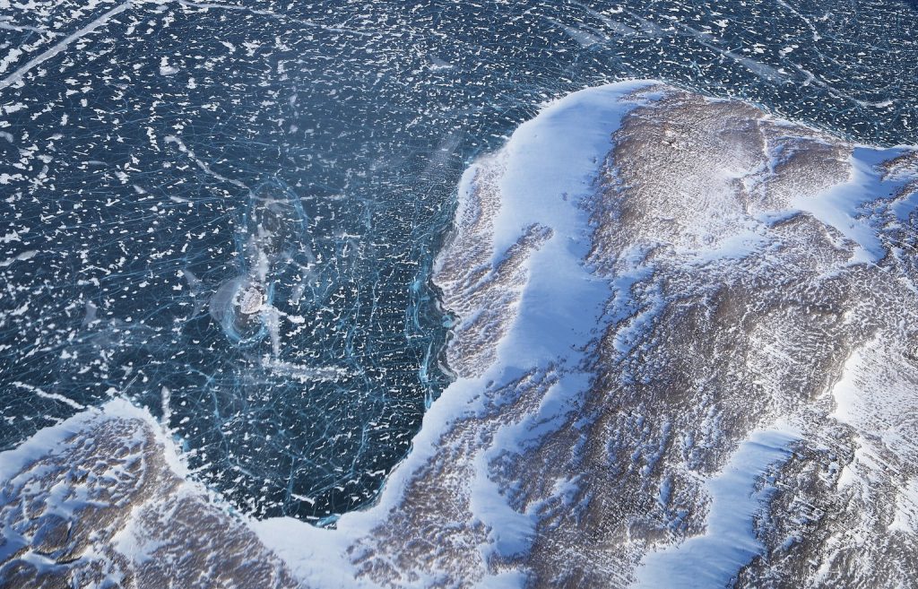
Ice along the Baffin Island coast Greenland. NASA photo.

NASA avionics technician surveys the Arctic landscape. NASA photo.
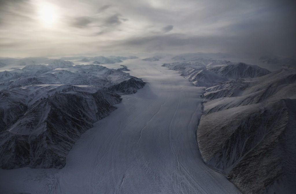
Glacier on Ellesmere Island. NASA photo.
Baffin coast ice field Greenland. NASA photo.
by Steve Selden | Apr 15, 2017 | Churchill Photography
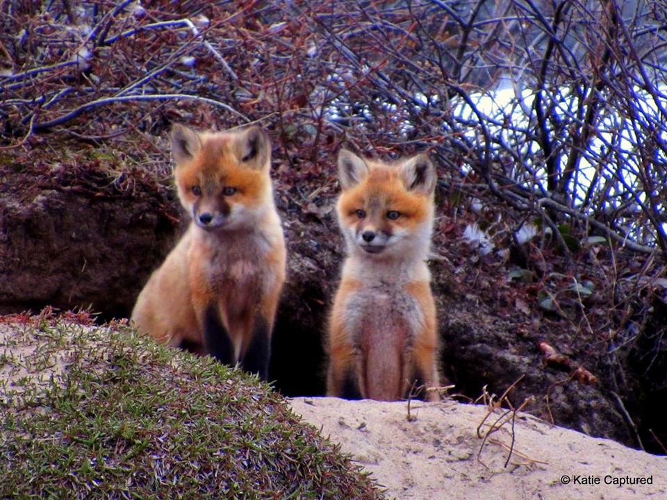
A pair of young red foxes at their den entryway. Katie deMeulles photo.
This classic shot of a pair of red foxes at the opening to a secluded den in Churchill signals the start of spring. It will be interesting to see what bounty of wildlife appears in Churchill this spring and summer after a prolonged and ferocious winter. Stay posted for updates from the tundra!
by Steve Selden | Apr 13, 2017 | Churchill News

Railroad ties owned by Omnitrax in the Pas were destroyed by arson. RCMP photo.
A $5,000 reward is being offered by Omnitrax Canada for information that helps locate an arsonist that destroyed about $1 million worth of railroad ties that were to be used this summer on the Hudson Bay rail – line.
Fire lit up the sky around 5:30 a.m. in The Pas Monday morning from the Hudson Bay Railway yard. With relations strained between local residents and Omnitrax due to their recent abandonment of the Port of Churchill, communities all along the Hudson Bay rail-line are running high on emotions.
Omnitrax will offer the bounty to someone who can supply information leading to both an arrest and conviction of the person or people responsible for the fire. Fortunately, no people were injured during the blaze.
“We are very troubled by this terrible act,” Omnitrax Canada president Merv Tweed said in a release.
The company has set up a tip line at 204-947-0033. The local RCMP number is 204-627-6204.
by Steve Selden | Apr 10, 2017 | Videos
With only a couple of weeks left in the operation of the ice road on the McKenzie River, there’s still some action happening. Randy Henderson narrates this phenomenal reindeer crossing. This is the final year of the Inuvik to Tuktoyaktuk roadway over ice. Normally the road closes down for the season right around April 28th though this year it will close for good.
Starting at the beginning of 2017-18 the seasonal ice road, one of many in the north, will be replaced by an overland highway suitable for all seasons. The project has been in the planning stages for decades but with the rapid growth and opening up of the Arctic the time is here for construction. Let’s hope the new road will not carry tolls.