Hold your breath and hope for the best for this Arctic hare as these wolves pursue him at high speed. This is survival of the fittest in the purest sense. Another interesting fact about Arctic Hares, that I used to teach travelers to Churchill working as a guide for Natural Habitat Adventures, is that their black – tipped ears are a distraction and target for raptor predators. The birds focus on the spots and attempt to grab the hare by those dark natural targets instead of the neck or fleshy body. Since they are moving and thinner, they are hard to grab on to. These creatures are quite adapted to the Arctic environment!
Old Yakutian cemetery where the deep thawing has exceeded one meter. Array photo.
This is something global warming proponents could not have predicted when temperatures began to rise faster than expected in the Arctic. Is it possible that a disease that has been eradicated from the world could reemerge again?
Scientists from Russia are worried that deadly diseases such as smallpox and anthrax could be released back into the human population via the thawing of ground covering Arctic graves in a report released by The Sun UK. An anthrax outbreak in the Yamal peninsula last year caused the death of one child and nearly 2,500 reindeer. Thawing reindeer graves is blamed on this particular outbreak and was fairly harmless to people though the fear that smallpox could be released in the same fashion is now prevalent.
Disinfection of the territory in the area of anthrax outbreak in Yamal. Siberian Times photo.
Russian scientists are concerned that smallpox could be released from Arctic graves in Siberia where thawing is occurring three times faster than usual. Climate change is the driving factor behind the melting scientists argue.
The primary concern stems from an 1890’s smallpox epidemic that killed almost half the population in eastern Siberia. Boris Kerhengolts, Deputy Director for research at the Institiute of Biological Problems of the Cryolithozone in Yakutsk, issued a concerning statement; “during the 1890s, a major epidemic of smallpox occurred in a town near the Kolyma River in eastern Siberia, and up to 40 percent of the population died. Their bodies were quickly buried under the upper layer of permafrost soil. A little more than 100 years later, Kolyma’s flood waters have started eroding the banks.”
Mikhail Grigoriev, Deputy Director of the Permafrost Studies Institute, says “The rock and soil that forms the Yamal Peninsula contains much ice, melting may loosen the soil rather quickly, so the probability is high that old cattle graves may come to the surface.”
Dangers other than smallpox and anthrax might be released from the shallow Arctic graves. Increased melting will possibly unveil centuries – old dangers in the near future.
Some pretty incredible images from Nunavut and the far north. We love posting a glimpse of life in the Arctic since the colors and vastness of the landscape are truly unique and fascinating. The simplicity in life and the enduring landscape give one a sense of timelessness. Churchill summer adventures will soon provide a platform to see and interact with the natural treasures of the Arctic. Enjoy!
Northwest Territories’ Canol Trail. Jared David Sean Etchinelle photo.
Taloyoak, Nunavut! Life in the north in a mini amauti. Charlene Aningak Pauloosie photo.
Majestic northern sunrise.CBC photo.
Gorgeous day for a ski in Cape Dorset, Nunavut. Manny Noble photo.
Northern lights burst into the sky over Pangnirtung, Nunavut. Mike Helms photo.
Enjoying the beautiful day in Coral Harbour. Sabrina Nakoolak photo.
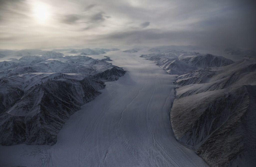
Mario Tama photographed these breathless Arctic photos from a Lockheed P-3 accompanying a NASA crew carrying out Operation Icebridge, an operation initiated to measure Earth’s glaciers and ice sheets. The stillness, colors and textures of the Arctic landscape left Tama speechless.
“It’s such an unexpected landscape,” he says. “It felt like we were flying over a different planet.”
NASA spends 10 weeks each spring in the Arctic when the ice levels are at their highest using a pair of laser altimeters to record ice elevation and three types of radars to measure snow – one of which reaches 300 feet down to bedrock. Flying shifts of up to 12 hours, the crew surveyed hundreds of miles of coastline along Ellesmere Island in Canada and Greenland. While researchers focused on computer screens, Tama focused his camera on a landscape without scale.
“I was looking at shapes and features that I had never seen in my life,” Tama says. “We’d drop through the clouds or take a turn into a valley, and I’d be sitting there trying to process, what am I looking at?”
Last year the National Snow and Ice Data Center NASA and operation IceBridge announced the lowest ice levels for the Arctic and Antarctic in the past 38 years.
“Changes in Arctic sea ice is seen as one of the primary indicators of climate change,” says Nathan Kurtz, project scientist for Operation IceBridge. “It’s been changing so rapidly—the Arctic has been changing and warming. What we’re trying to do is get a sense of what’s driving some of the bigger changes that we’re seeing.”
Tama’s stunning images remind us all of the majestic beauty of the north that is in jeopardy due to global warming!
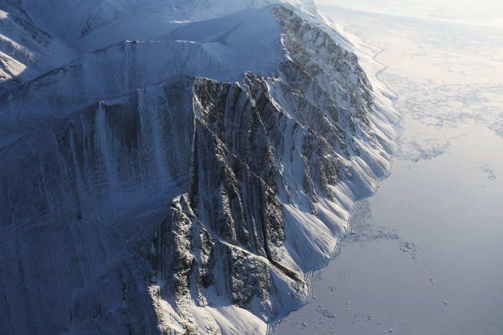
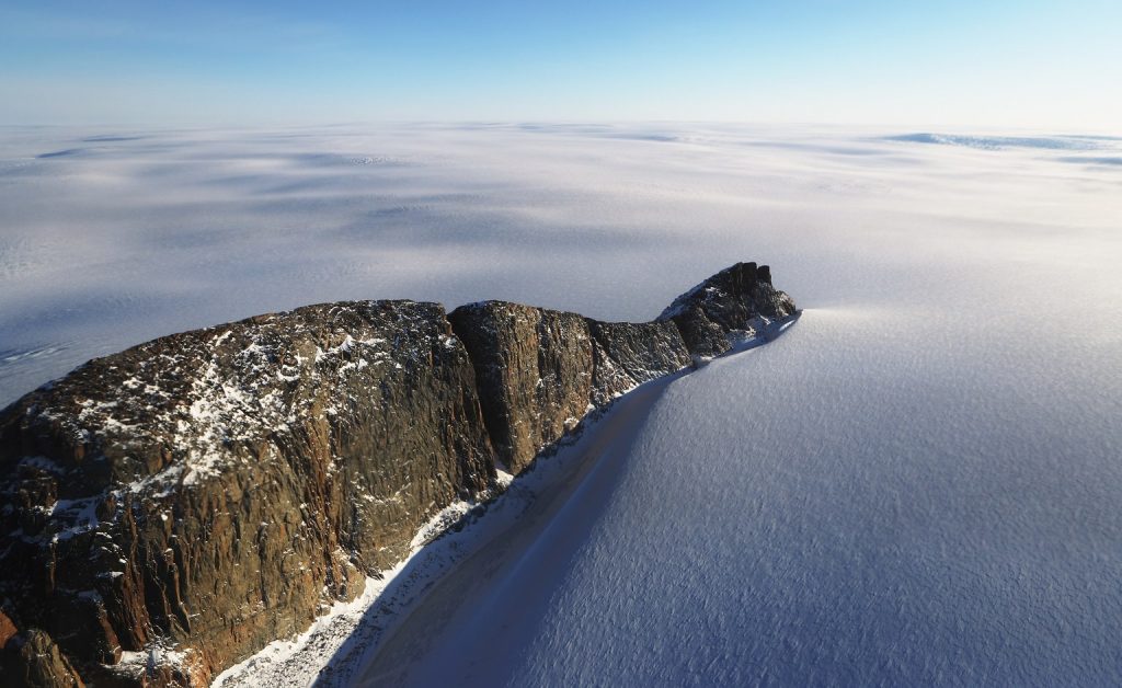
Ellesmere Island ice field. NASA photo.
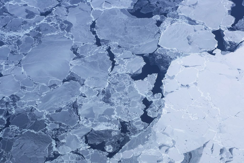
Ice pack near Ellesmere Island. NASA photo.
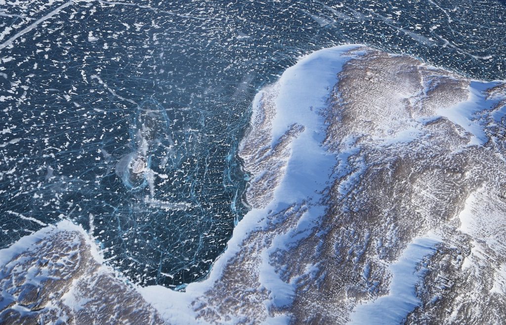
Ice along the Baffin Island coast Greenland. NASA photo.
NASA avionics technician surveys the Arctic landscape. NASA photo.
With only a couple of weeks left in the operation of the ice road on the McKenzie River, there’s still some action happening. Randy Henderson narrates this phenomenal reindeer crossing. This is the final year of the Inuvik to Tuktoyaktuk roadway over ice. Normally the road closes down for the season right around April 28th though this year it will close for good.
Starting at the beginning of 2017-18 the seasonal ice road, one of many in the north, will be replaced by an overland highway suitable for all seasons. The project has been in the planning stages for decades but with the rapid growth and opening up of the Arctic the time is here for construction. Let’s hope the new road will not carry tolls.